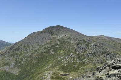
Mount Adams, at 5,797 feet, is the second highest peak in New Hampshire and the entire northeastern United States, surpassed only by its near neighbor Mount Washington. Named for the second U.S. president in 1820, Adams anchors the northern Presidential Range, with satellite summits honoring the Adams family, including Sam Adams and Quincy Adams, scattered along its flanks. The summit is a sprawling field of angular granite talus with a 360-degree panorama, including a direct sightline south to Mount Washington and wide views across the Great Gulf Wilderness.
Several trails depart from the Appalachia trailhead on Route 2 in Randolph. The Air Line is the most direct, following Durand Ridge to a narrow knife edge, with the final thousand feet entirely exposed to wind above treeline. The Valley Way is gentler and connects through Madison Spring Hut, making it a natural choice for combining Adams with neighboring Mount Madison. The King Ravine route is the most dramatic, ascending through a glacial cirque filled with house-sized boulders and an optional passage through the boulder-cave "Subway." All routes gain around 4,500 feet over four to five miles.
Weather can turn dangerous here with little warning at any season. Winter conditions on Adams have been compared to the worst on record from Antarctica, and a prominent sign near the ridge urges retreat at the first sign of approaching weather. Most hikers visit from late spring through early fall; anyone heading above treeline should monitor higher summits forecasts and carry layers regardless of season.
 David Andre


