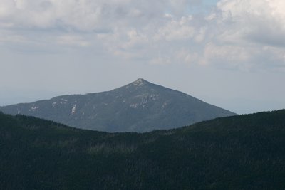
Mount Garfield rises to 4,501 feet at the northern end of the Franconia Range, bordering the Pemigewasset Wilderness. Its pyramidal summit cone is one of the more distinctive shapes in the western White Mountains, and the views rank among the most panoramic of the NH 48: Lafayette and Lincoln dominate to the south, the Twin and Bond ranges fill the east, and the Franconia Notch corridor opens to the west. A concrete foundation from a long-gone fire lookout marks the highest point.
The standard route is the Garfield Trail, a 10-mile out-and-back with about 3,000 feet of gain. The trail follows the South Branch Gale River drainage and holds moderate grade for most of its length, with the climbing concentrated in the final quarter mile up the rocky cone to the Appalachian Trail junction. The nearby Garfield Ridge Campsite makes this peak a natural anchor for a Pemi loop backpacking trip.
Gale River Loop Road is gated in winter, adding 2.4 miles of road walking round-trip from Route 3. Hard-sided bear canisters are required for overnight stays in the Pemigewasset Wilderness. Garfield Pond, a quiet tarn, sits about a half mile east along the ridge and is worth a brief detour on the return.