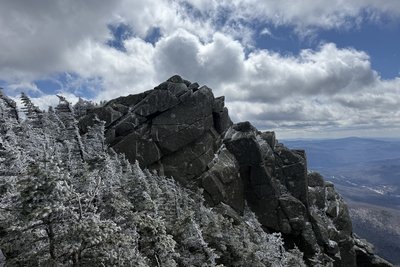
Mount Liberty rises to 4,457 feet at the southern end of the Franconia Range, between Mount Flume to the south and Mount Lincoln to the north. The rocky, open summit yields a full 360-degree panorama: the Presidential Range to the east, Cannon Mountain and the Kinsman Ridge to the west, Mount Garfield and the Twin Range to the northeast, and the wooded expanse of the Pemigewasset Wilderness spread below. The summit lies on the Appalachian Trail, connecting it to the full Franconia ridge walk.
The standard approach is the Liberty Spring Trail, 4.1 miles to the summit with 3,150 feet of gain, starting from the Whitehouse Trailhead near the Flume Gorge Visitor Center in Lincoln. About half a mile below the top, the AMC-staffed Liberty Spring Tentsite provides an overnight base suited for catching a summit sunrise. Many hikers pair Liberty with Mount Flume in a 9.4-mile loop, ascending the steep Flume Slide Trail to Flume first, then traversing north to Liberty and descending the Liberty Spring Trail.
Snow lingers on the upper trail well into May, and the exposed summit amplifies wind beyond what conditions feel like at the trailhead. Summer weekends see steady foot traffic, though Liberty draws far fewer visitors than the higher peaks farther north along the ridge.
 David Andre


