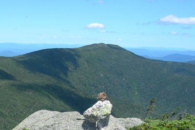
Middle Carter Mountain rises to 4,624 feet along the Carter-Moriah Range, which runs northeast of Pinkham Notch in New Hampshire's White Mountains. Positioned between North Carter Mountain to the north and South Carter Mountain to the south, Middle Carter is a classic ridge-walk summit, with the Appalachian Trail passing directly over its wooded high point.
The summit itself is forested and viewless, but the ridgecrest of the Carter-Moriah Trail just before and after the top delivers some of the most rewarding scenery on the route: open views west toward Mount Washington and the Northern Presidentials, and east across the Wild River Wilderness to the Baldface Range. The standard approach follows the Nineteen Mile Brook Trail and Carter Dome Trail to Zeta Pass, then the AT north past South Carter to the summit, a round trip of about 10 miles. A loop variation descends via the North Carter Trail to the Imp Trail back to Route 16, though it adds about 1.5 miles of road walking to reach the trailhead.
Winter conditions on the Carter-Moriah Range arrive early and linger, with snowshoes or crampons typically needed from November into April. The ridgecrest is exposed to rapidly changing mountain weather. Early October brings vivid hardwood color on the lower slopes, and the eastward views toward the Baldfaces are especially striking at peak foliage.