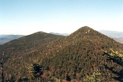
Middle Tripyramid (4,135 ft) is the middle peak of a three-summit ridge in the Sandwich Range of the White Mountains, flanked by North Tripyramid to the north and South Tripyramid to the south. Both North and Middle qualify for the NH 4,000-footers list; South Tripyramid, despite clearing 4,000 feet, lacks the required 200-foot topographic prominence. The summit of Middle is densely forested, with only partial glimpses through the trees toward Waterville Valley.
The standard route is the Tripyramid Loop from Waterville Valley, roughly 11 miles with 3,000 feet of gain. The approach follows Livermore Road before reaching the slide loop. Hikers typically ascend the North Slide first: a sustained scramble up bare granite slabs and loose rock that gains about 1,200 feet in half a mile, requiring hands and feet throughout. The best open views come on the slide itself, before the trail narrows into the trees near the top of North Tripyramid. A rolling wooded ridge walk then leads south through Middle and on to South Tripyramid; a junction with the Sabbaday Brook Trail midway provides an alternate exit. The descent uses the South Slide, shorter and looser than the North but still steep before rejoining the valley floor.
Both slides become significantly more dangerous when wet or icy. Early-season snow and ice can linger well into spring, and summer afternoon thunderstorms can leave the exposed slabs hazardous. This is not a route for poor weather conditions.