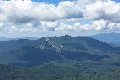
Mount Tecumseh sits at 3,995 feet in the Sandwich Range above Waterville Valley, and holds the distinction of being the lowest peak on the NH 48 list. Its proximity to Waterville Valley Ski Area makes it one of the more accessible 4,000-footers, with the ski slopes visible through the trees as you climb — and available as a descent route in the off-season.
The Mount Tecumseh Trail starts at the ski area parking lot and covers about 4.9 miles round trip with roughly 2,200 feet of gain. The lower section crosses Tecumseh Brook twice and climbs steadily past ski trail openings. The upper mile turns rough and rocky, requiring attention underfoot. Near the top, the Sosman Trail branches left, offering a gentler ridge traverse with an excellent lookout toward the Franconia and Kinsman ranges to the northwest. The summit trail itself splits into two paths that loop around the wooded cone.
The summit is forested but not without views: clearings reveal Waterville Valley below, the Tripyramids across the drainage, and the Sandwich Range to the south. A short spur just below the top opens northwesterly sightlines toward the Presidentials. An alternative approach from Tripoli Road on the west side provides a slightly shorter but steeper option.