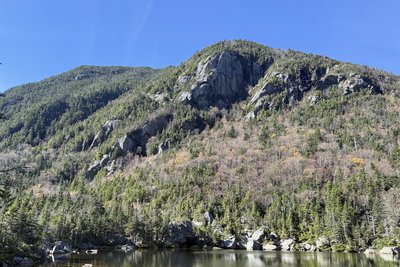
Wildcat Mountain's A Peak is the highest point on the long Wildcat Ridge, which runs northeast above Pinkham Notch on the east side of Route 16. At 4,399 feet, the summit faces Mount Washington and the Presidential Range head-on, with the western skyline entirely filled by the Presidentials and little to interrupt the sightlines. To the northeast, the rocky bowl of Carter Notch drops sharply below, with Carter Dome rising across the gap.
The main approach follows the Wildcat Ridge Trail, which coincides with the Appalachian Trail. The trailhead is on Route 16 opposite Glen Ellis Falls, a short distance south of the Pinkham Notch Visitor Center. The opening mile climbs relentlessly through rocky terrain, and the full 4.2-mile route to A Peak accumulates roughly 3,150 feet of gain. Hikers bound for A typically cross Wildcat D along the way. A summer alternative uses ski area terrain to reach D before following the ridge north to A, trimming some elevation gain; the lifts do not operate for hiking. The ridge involves a series of smaller ups and downs between the lettered summits, with partial views opening at several points before the A summit fully clears.
Winter and early spring conditions on Wildcat can be serious: the exposed ridge holds ice late into the season, and crampons and poles are often warranted. The trail can be extended beyond A to Carter Notch Hut, adding mileage and a sharp descent into the notch.