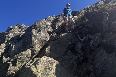
The Caps Ridge Trail begins at Jefferson Notch Road, the highest trailhead reachable by public road in the White Mountains, sitting at around 3,008 feet. That head start is deceptive: the trail still climbs roughly 2,700 feet over 2.1 miles to the summit of Mt. Jefferson, and the upper half is entirely above treeline, exposed to whatever weather rolls in off the Presidentials.
The trail's defining feature is a series of three rocky ledges, the Caps, that require sustained hand-and-foot scrambling on open granite. The holds are plentiful and the moves are manageable in dry conditions, but the cap sections become treacherous when wet, and lightning risk is severe given how long hikers spend fully exposed. The lower forest section transitions quickly through red spruce into krummholz before the trees disappear entirely, leaving no shelter for the final push. Jefferson Notch Road is a seasonal road, typically gated until late spring, so access windows matter; check the gate status before planning a trip. Once above the Caps, the route connects to the broader Presidential ridge network, including the Six Husbands Trail dropping into the Great Gulf and the Castle Trail traversing toward Mt. Adams.