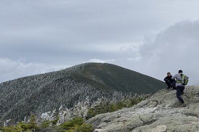
Carter Dome rises to 4,840 feet on the eastern side of Pinkham Notch, the high point of the Carter-Moriah Range and a direct neighbor to the Presidential Range across the notch. Local folklore holds that the mountain was named after a hunter named Carter, with neighboring Mount Hight honoring his hunting partner. The rounded, wooded upper flanks that give the peak its "Dome" character belie a summit with open views, particularly west toward the Presidentials.
The most traveled approach follows the Nineteen Mile Brook Trail from Route 16 in Pinkham Notch, climbing along a scenic brook before reaching Carter Notch and its two small alpine ponds. The AMC's Carter Notch Hut sits nearby and makes a good mid-hike stop. From the notch, the Carter-Moriah Trail, which coincides with the Appalachian Trail here, climbs steeply 1.2 miles to the summit. The round trip totals roughly 10 miles with about 3,500 feet of gain. Many hikers extend the outing by continuing 0.8 miles to Mount Hight, whose open summit provides some of the best views in the range, then looping back via Zeta Pass and the Carter Dome Trail.
Snow can linger in Carter Notch into May, and the steep pitch above becomes icy in winter and early spring, requiring traction devices. The Carter Notch Hut operates seasonally; check availability before planning to use it.
 David Andre


