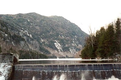
Mount Colvin rises to 4,057 feet in the Pinnacle Range of the Adirondacks, forming the high point at the southern end of the Ausable Lakes valley. The peak honors Verplanck Colvin, the 19th-century surveyor who mapped the Adirondack region. His party first reached the summit in August 1873 during a week-long bushwhack from Keene Valley, and a team member named the mountain after their leader, who had recorded it simply as Mount Sabele.
The standard route begins at the Adirondack Mountain Reserve (AMR) gate in St. Huberts, open to foot travel by the public. Hikers walk two miles along Lake Road before turning onto the Gill Brook Trail, which climbs at a moderate grade before steepening considerably. Fixed ladders and slab scrambling mark the final push to the summit. The out-and-back to Colvin alone covers around 12 miles with roughly 3,000 feet of gain; most hikers continue another 1.3 miles each way over a col to Blake Peak, bringing the full day to 15.7 miles and 4,100 feet of gain. Dogs are not permitted on AMR property, and water runs out past Gill Brook, so carry enough for the full ascent.
From the summit, Colvin commands an exceptional panorama: the Great Range rolls across the western horizon through Sawteeth, Gothics, Saddleback, Basin, Haystack, and Marcy, while Giant and Rocky Peak Ridge rise to the northeast.