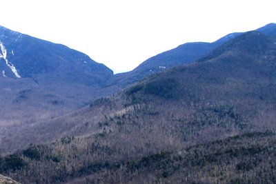
Dial Mountain sits at 4,020 feet in the heart of the Adirondack Mountain Reserve (AMR), flanked by Nippletop to the west and the Dix Range to the east. The name has a curious history: in 1837, state geologist Ebenezer Emmons applied "Dial" to what locals already called Nippletop, and the name eventually migrated to this adjacent summit instead. Though less celebrated than its taller neighbor, Dial's open rocky summit delivers panoramic views of the Great Range, Colvin, and Blake that reward the long approach.
Most hikers reach Dial as part of a ridgeline loop through the AMR, starting from the St. Huberts parking area in Keene Valley, where advance reservations are required through hikeamr.org. The standard route follows Lake Road and the Gill Brook Trail up through Elk Pass, summits Nippletop first, then traverses the ridge south to Dial before descending via Bear Den Mountain. The full loop covers roughly 14 miles with about 4,200 feet of elevation gain and typically takes 8 to 10 hours. Tackling Nippletop first, with its steep 1,100-foot push from Elk Pass, makes the descent to Dial a more comfortable ridge walk.
Water is scarce beyond Gill Brook, so carry a full supply from the trailhead. Snow lingers on the upper ridge into May, and afternoon thunderstorms are common in summer. Dogs are not permitted on AMR property.