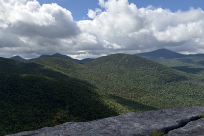
Table Top Mountain sits at the heart of the Adirondack High Peaks, its 4,304-foot summit forming a broad, wooded plateau that gave the peak its name when it first appeared on maps in 1876. The flat top is unmistakable once you arrive, a rare feature among the region's generally pointed summits. Though the peak lacks a maintained trail, a well-traveled herd path makes the summit accessible and keeps it among the more manageable of the trailless Adirondack 46.
The standard approach begins at the Adirondack Loj and follows the Van Hoevenberg Trail southwest into the High Peaks Wilderness. After passing Marcy Dam and continuing along Phelps Brook, hikers leave the main trail roughly half a mile past the Phelps Mountain junction to pick up the signed herd path. The path climbs steadily over about half a mile to the summit plateau, with stretches that can be eroded and wet through much of the season. Several route options are documented on AllTrails, with the round trip typically running around 10 miles and 2,600 feet of gain.
The summit is fully forested, but a short walk beyond the summit marker opens views across the Great Range. Table Top pairs naturally with Phelps Mountain, making it an efficient double-peak day. In winter, the herd path can disappear under snow and the low-lying approach terrain ices up early, so cold-season attempts call for careful route-finding.