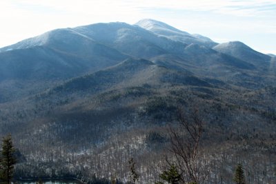
Wright Peak rises to 4,580 feet as the northernmost major summit of the MacIntyre Range, just above the treeline where the alpine zone begins. Named by Verplanck Colvin in 1873 for former New York governor Silas Wright, the peak carries a piece of Cold War history: on January 16, 1962, a B-47 bomber from Plattsburgh Air Force Base veered off course in foul weather and struck the upper slopes, killing all four crewmen. Fragments of the wreckage remain visible below the summit, and a bronze plaque set into a nearby rock commemorates the crew. The two landslide paths on the southeastern slopes, known as the Left Wing and Right Wing slides, were named for the wings of that aircraft.
The standard approach departs from the Adirondak Loj, following the Van Hoevenberg Trail before joining the yellow-blazed route toward Algonquin Peak. A blue-blazed spur branches left at 3.4 miles and covers the final 0.4 miles to the summit, for a round trip of roughly 7.6 miles with about 2,400 feet of climbing. Route details and reviews cover the full approach. Wright is frequently combined with neighboring Algonquin, and sometimes Iroquois, making it a natural multi-peak day for pursuers of the Adirondack 46ers. In winter the mountain draws backcountry skiers, though avalanche conditions on its steep slides have caused serious incidents; snow assessment is essential before venturing onto the upper slopes.
The treeless summit offers broad views of the High Peaks, including Algonquin, Iroquois, and Mount Colden, from a windswept perch.